Townsite Streetscape
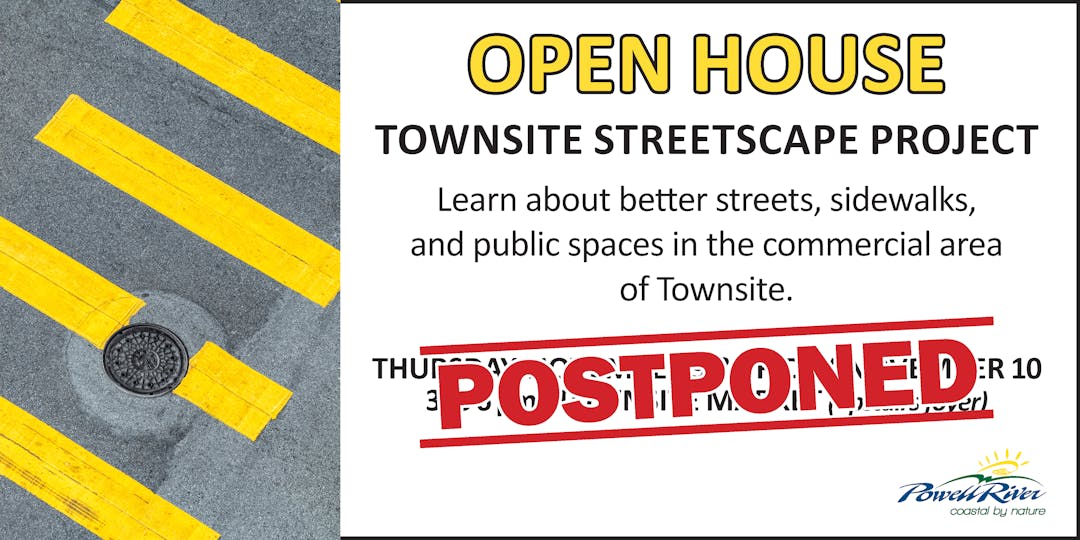
UPDATE! We are postponing the Townsite Streetscape event that was scheduled for November 9 and 10 at Townsite Market. Please stay tuned for updates.
Strengthening Townsite's Sense of Place
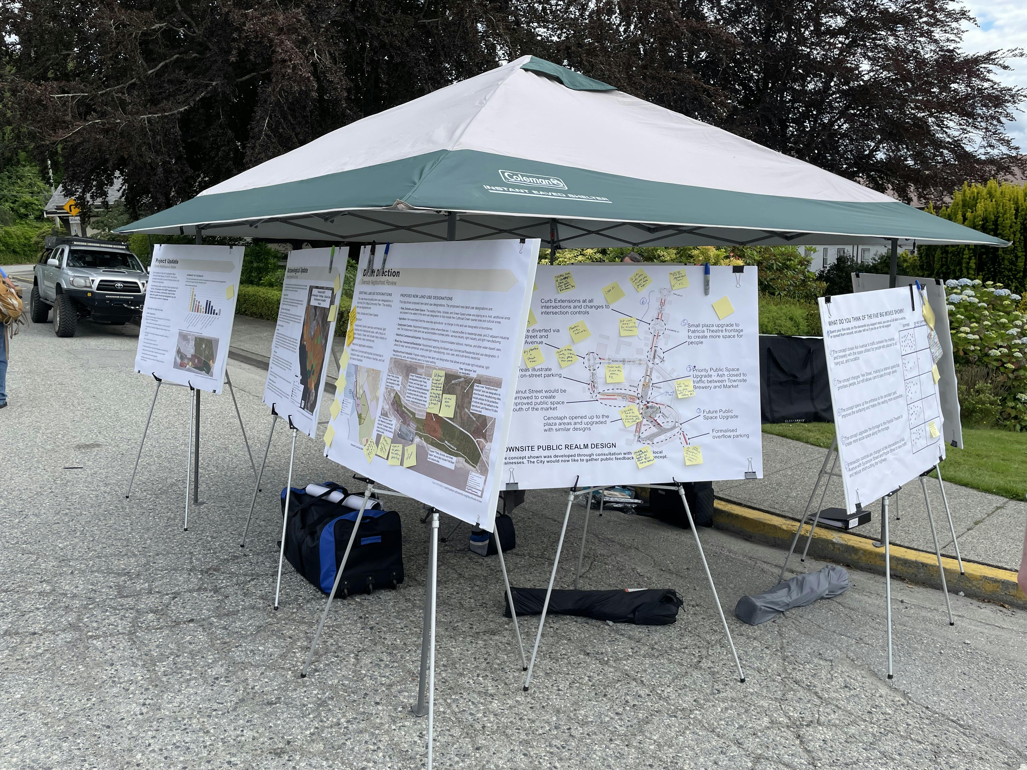
The City brought on ISL Engineering to look at pedestrian safety, cycling connectivity, on-street parking, and placemaking opportunities in the Townsite. Over time, we've heard that people are concerned about the lack of investment in Townsite's streets, sidewalks, and beautification. This project provides an opportunity to look at sidewalks, street trees, storm water management, street furniture, lighting and the configuration of streets to improve the appearance and create an even stronger sense of place in the Townsite, with a specific focus on Ash Avenue and Walnut Street.
Building on 20th Century Heritage
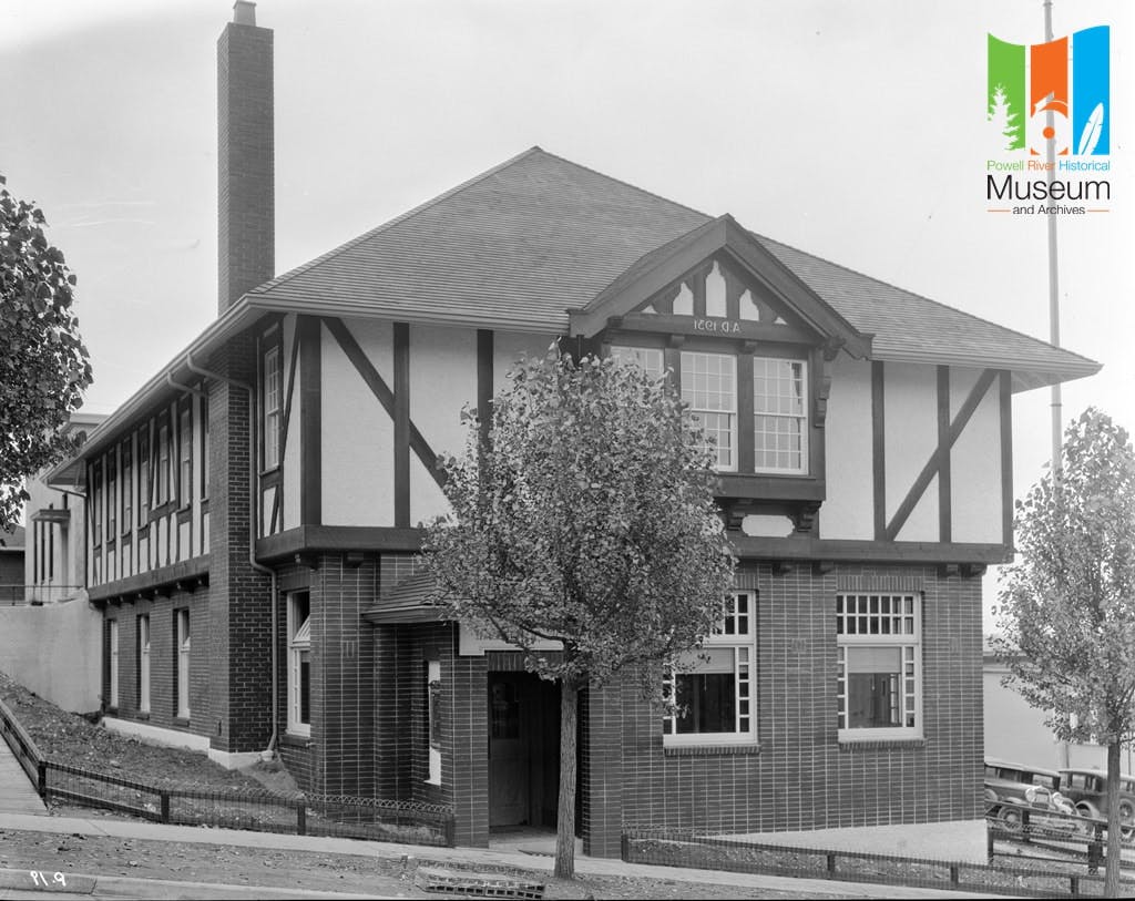
Townsite National Historic District was designated as the first National Historic Site of Canada in BC by the federal government in 1995, recognizing the historical, cultural, and architectural importance of its built heritage.
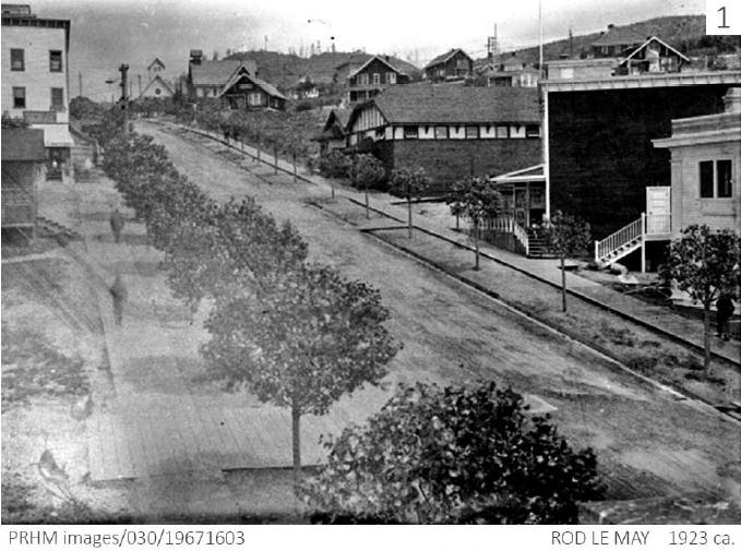
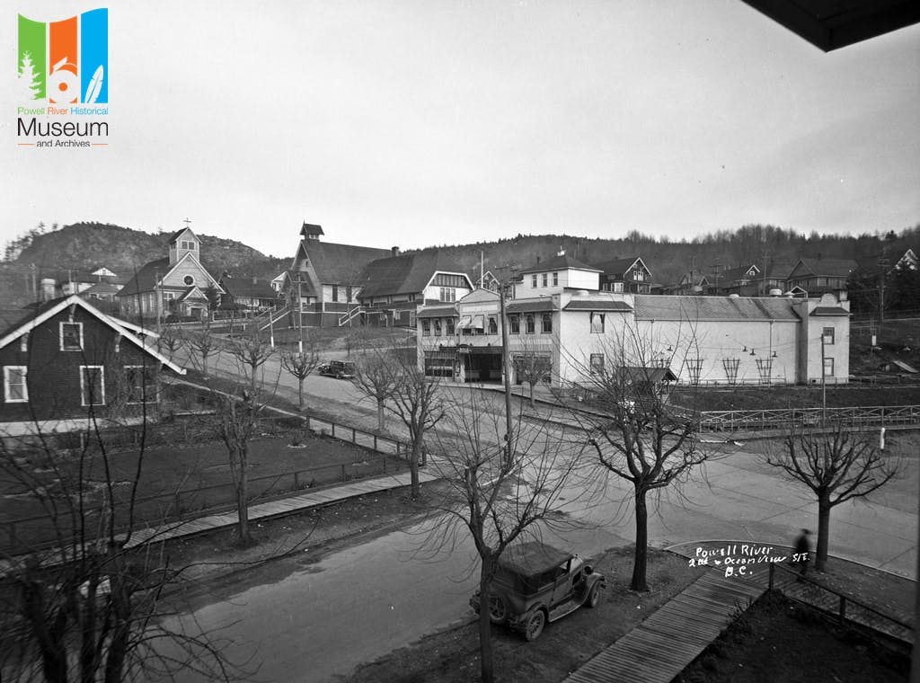
Please see "Historical Photos" in the sidebar to see how Ash Avenue, Walnut Street, and Marine Avenue used to look. You'll see wooden sidewalks, street trees, and wide boulevard areas. The neighbourhood plan was developed by Powell River Company in 1911. The design of the streets reflect the goal of the garden city movement to create mixed-income, mixed-use walkable neighbourhoods in a natural setting with a cohesive central vision.
Building on Indigenous Heritage and Contemporary Values
ɬəʔamɛn (Tla'amin) have lived on this land since time immemorial. Archaeological evidence documents ɬəʔamɛn having lived in this region for over 7000 years. ɬəʔamɛn first recorded contact with Europeans in 1792 when Captain George Vancouver's ships were on the shores of ʔagayqsən (Ahgykson or Harwood Island). tiskʷat (‘big/wide river’) was the main traditional Tla'amin village site in the region. In 1909, the Brooks/Scanlon O'Brien firm consolidated with a local power company to form the Powell River Company and develop the pulp and paper mill. From 1910 to 1915 ɬəʔamɛn people were forcibly removed to IR#1, and members of the community stayed to protest the demolition of their homes.
The Tla'amin Nation website and the qathet Museum & Archives have more information about our area's history.
Building on Good Planning and Design Practices
Over the last 100 years, planning and design practices have come full-circle to value compact mixed-use neighbourhoods where people can meet most of their daily needs within walking distance. But, there have also been changes in the last century, especially in relationship to cars. From the 1950s onwards, planning and engineering practices prioritized the fast and uninterrupted travel for a high volume of vehicles. But, we now know that this way of designing streets reduced street safety, especially for youth, seniors, and for people with disabilities.